Searcher | Is there a risk of fire where you live? Check it on this map updated every day

The large active fires in Zaragoza, Guadalajara, or Madrid have once again brought attention to the fire risk in a good part of Spain. With this search engine, you can check each day the level of fire danger predicted by AEMET in any municipality and see if your locality is in a very low, low, moderate, high, very high, or extreme risk area.

3 minutes

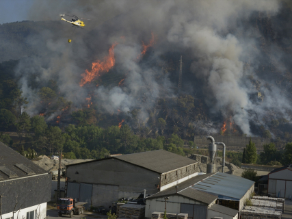
EuropaPress 7661047 helicopteros bombarderos trabajan tareas extincion incendio forestal ribas (1)

EuropaPress 7661047 helicopteros bombarderos trabajan tareas extincion incendio forestal ribas (1)

Add DEMÓCRATA to Google

Ask FREN

Published

Last updated

3 minutes

Most read

The summer of 2026 is leaving a succession of large wildfires that keeps numerous autonomous communities on alert. The high temperatures, low humidity, wind, and accumulated dryness of the vegetation are favoring the spread of the flames and raising the risk of new fires.

In light of this situation, thousands of people search every day to see if there is a fire danger in their municipality or if the area in which they live presents an especially high risk. To facilitate this inquiry, DEMÓCRATA offers a search engine updated daily with the official data from the State Meteorological Agency (AEMET).

Search engine: check the fire risk today in your municipality

Enter the name of your municipality in the search engine to know the level of wildfire risk forecasted today according to AEMET. The search engine is updated daily and shows the situation in more than 8,000 Spanish municipalities through the Wildfire Danger Index (IPIF).

The system classifies the risk into six levels:

  1. Very low
  2. Low
  3. Moderate
  4. High
  5. Very high
  6. Extreme

Each municipality appears classified according to the predominant level forecasted for that day.

How the fire risk map works

The search engine uses the information published daily by the State Meteorological Agency through its *Wildfire Danger Index (IPIF).

This system combines different meteorological variables that directly influence the possibility of a wildfire starting and spreading, among them:

  • Temperature.
  • Relative humidity.
  • Wind speed and direction.
  • Accumulated precipitation.
  • State of the vegetation.

With all this data, AEMET prepares a forecast map that allows estimating the level of danger existing at each point of the national territory.

What each risk level means

The index used by AEMET divides the fire risk into six categories:

  • Very low* and low indicate that the weather conditions are not favorable for the start of a large fire.
  • The moderate level advises taking extra precautions, especially in activities that may generate sparks or flames.
  • When the risk becomes high, very high, or extreme, the chances of a fire starting and spreading rapidly increase considerably, especially if episodes of intense wind or very high temperatures coincide.

In these situations, many autonomous communities activate restrictions on certain outdoor activities.

Active fires raise concern across Spain

The interest in knowing the fire risk has skyrocketed coinciding with the large fires recorded in different parts of the country.

The fire in Orés, in the Zaragoza region of Cinco Villas, has become one of the most important of the summer after devastating thousands of hectares and forcing the evacuation of several municipalities. Fires in Guadalajara, Madrid, and other parts of Spain also remain under surveillance.

The combination of extreme heat, very dry vegetation, and wind keeps the risk high in numerous areas during these days.

What to do if your municipality presents extreme fire risk

That a municipality appears with extreme risk does not mean that a fire will occur, but it does indicate that the weather conditions favor any spark spreading rapidly.

In these cases, authorities recommend avoiding any activity that may generate fire or sparks, respecting the current autonomous restrictions and immediately notifying 112 if a column of smoke or a possible forest fire is detected.

Citizen collaboration is essential to detect fires in their early stages and facilitate a rapid intervention by emergency services.

 Where the data from the search engine comes from

The data used in this search engine comes from the official maps of the Forest Fire Danger Prediction System of the State Meteorological Agency (AEMET), extracted by EP Data.

To assign the risk level to each municipality, the official limits of the National Geographic Institute (IGN) are used, calculating the predominant level within each municipal term based on the geographical information published daily by AEMET.

In this way, the search engine offers a simple and updated query to know the predicted forest fire risk in any locality in Spain.

More key points, information and questions with FREN

AI-GENERATED CONTENT

What is the process for declaring a national interest emergency due to forest fires in Spain, and what competencies do the regional and state authorities have in this matter?

The declaration of a national interest emergency due to forest fires in Spain is based on Law 17/2015 of the National Civil Protection System and the State Civil Protection Plan for Forest Fire Emergencies. Legally, the authority to declare it corresponds to the Minister of the Interior, while the ordinary management of fires and the initial response fall to the autonomous communities. When national interest is declared, political direction and general coordination pass to the State, but the regional services remain the operational core on the ground. All this is articulated through regional territorial and special plans, the State Fire Plan, and the General State Emergency Plan (PLEGEM).

Basic regulatory framework

The central pillar is Law 17/2015, of July 9, on the National Civil Protection System, which defines the system, types of emergencies, and the distribution of competencies between the State and the autonomous communities. It can be consulted in the BOE at Law 17/2015.

Its articles (according to the available excerpts) establish that:

  • The National Civil Protection System integrates the actions of all Administrations, under principles of collaboration, cooperation, coordination, and interterritorial solidarity.
  • The State's operational intervention focuses on national interest emergencies, for which the directive and coordination powers of the Ministry of the Interior are reinforced.
  • The National Center for Monitoring and Coordination of Civil Protection Emergencies acts as the Operational Coordination Center in national interest emergencies, integrating the regional coordination centers within it.
  • It is expressly foreseen that the Minister of the Interior can declare the national interest emergency and its termination, and in such case assumes direction and coordination.

The practical application and coordination architecture are developed in the General State Emergency Plan for Civil Protection (PLEGEM), approved by the Council of Ministers Agreement of December 15, 2020, published by Resolution of December 16, 2020 (PLEGEM).

Specific plan for forest fires

For the specific risk of forest fires, the key instrument is the State Civil Protection Plan for Forest Fire Emergencies, approved by Council of Ministers Agreement of October 24, 2014, and published by Resolution of October 31, 2014 (State Fire Plan), complemented by an erratum (erratum).

This Plan, developed under the Basic Guideline for forest fire emergency planning, establishes that:

  • Its purpose is to organize State resources and services to ensure an effective response when a forest fire involves national interest, and to support regional plans when they require it or lack sufficient capacity.
  • It foresees different phases, including a “national interest emergency phase” (expressly corrected in the erratum), in which the highest level of State coordination is activated.

Procedure for declaring a national interest emergency

Combining Law 17/2015, PLEGEM, and the State Fire Plan, the general scheme for a large forest fire is as follows:

  • 1. Initial regional management: the fire is managed under the regional special forest fire plans. The autonomous community declares its internal emergency levels and directs the extinction, being able to request State resources (Military Emergency Unit, aerial means, etc.).
  • 2. Assessment of national interest: when the magnitude, impact on several communities, effect on essential services, or incapacity of regional means justify it, the situation may fit the national interest emergency cases regulated by Law 17/2015 (articles 28 and 29, cited as basis in recent regulations such as Order INT/399/2025, Order INT/399/2025).
  • 3. Technical and political proposal: from the Directorate General of Civil Protection and Emergencies and the National Monitoring and Coordination Center, the proposal is submitted to the Minister of the Interior, in coordination with the affected autonomous communities and, if applicable, other ministries.
  • 4. Formal declaration: the Minister of the Interior declares the national interest emergency by resolution or order published in the BOE (the scheme can be seen, for example, in the cited Order INT/399/2025, although referring to another type of emergency). This declaration activates PLEGEM and the State Fire Plan in its national interest phase.
  • 5. Direction and coordination: the Ministry of the Interior assumes the political direction and general coordination of all Administrations; the National Center acts as the State Operational Coordination Center (COP) and the regional centers are operationally integrated into it. The Military Emergency Unit assumes operational direction of the State intervention, acting under the Minister of the Interior's direction.
  • 6. Inter-administrative cooperation: according to PLEGEM, the regional direction committees of territorial plans continue operating but coordinated with the State Coordination and Direction Committee (CECOD). The State must make its human and material resources available to the communities, and these maintain their prevention and extinction services deployed.

Distribution of competencies between State and autonomous communities

In summary, Law 17/2015 configures a distribution of competencies where:

  • The autonomous communities have ordinary competence in prevention, planning, and extinction of forest fires, approve their special plans, and manage most operational services.
  • The General State Administration assumes:
    • The general direction and coordination of the System in national interest emergencies.
    • The approval of the Basic Civil Protection Standard, PLEGEM, and the special state plans, including the State Fire Plan.
    • The mobilization of State means (UME, State Security Forces and Corps, and others) and international coordination.

Consequently, the declaration of a national interest emergency due to a large forest fire does not displace the autonomous community but raises the command and coordination level to the State to ensure a unified response and optimal use of all available resources.

In what specific cases does Law 17/2015 allow declaring a national interest emergency in a forest fire? How is the integration of regional emergency centers into the National Center practically articulated during a national interest emergency? What exact role does the Military Emergency Unit play in large forest fires declared of national interest?

What are the functions and powers of the State Meteorological Agency (AEMET) in the prevention and management of forest fires?

The State Meteorological Agency (AEMET) is the national meteorological service and plays a central role in the prevention, planning, and operational support against forest fires. Its functions are generally defined in its Statute and specifically in civil protection and forest fire regulations. In summary, AEMET: evaluates and predicts meteorological fire danger, prepares and disseminates warnings and risk maps, supports real-time firefighting efforts, and participates in civil protection coordination bodies.

1. General framework: AEMET Statute

Royal Decree 186/2008, which approves the AEMET Statute, establishes that the Agency is responsible for the preparation, supply, and dissemination of meteorological information and forecasts of general interest, as well as the issuance of warnings of meteorological phenomena that may affect the safety of people and property. This basis enables its intervention in forest fires as the State meteorological service, under article 149.1.20 of the Constitution. It can be consulted at Royal Decree 186/2008.

2. Prevention: evaluation and prediction of fire danger

Sectoral forestry and forest fire regulations assign AEMET a key role in risk prediction:

  • Law 43/2003, on Forests: establishes that when, according to AEMET meteorological information, a very high or extreme fire risk is predictable in a territorial area, the autonomous communities must immediately apply the prohibitions and access and use limitations provided in their prevention, surveillance, and extinction plans. It also foresees that AEMET publishes and keeps updated on its portal the forecast of meteorological forest fire risk levels with georeferenced information and collaborates with the autonomous communities in this regard. See Law 43/2003 on Forests.
  • Royal Decree-law 15/2022: reinforces this scheme by linking the activation of a minimum catalog of prohibitions when the risk is very high or extreme to the information that AEMET must keep updated and available to the autonomous communities. It can be consulted at Royal Decree-law 15/2022.

In the State Civil Protection Plan for Forest Fire Emergencies, approved by Council of Ministers Agreement and published by Resolution of October 31, 2014, this preventive function is further detailed:

  • AEMET prepares daily, for the entire national territory, a forecast of at least 24 hours of the variables necessary for a meteorological forest fire danger index.
  • It generates indicators on fuel moisture, drought, potential spread, intensity, and fuel availability, and supplies them in numerical and cartographic formats.

3. Planning and civil protection information systems

State and basic civil protection planning explicitly incorporates AEMET:

  • The Basic Guideline for Civil Protection Planning for Forest Fires, approved by Royal Decree 893/2013 (partially modified later), defines the Meteorological Information System for estimating forest fire danger as the set of actions carried out by AEMET to have hazard indices and other information, as well as procedures for their transmission nationally and to the autonomous communities.
  • This same Guideline foresees that the State Plan establishes the procedure to have meteorological forest fire danger maps prepared by AEMET, integrated into a coordinated information and alert system.
  • The 2014 State Plan establishes that these data are electronically disseminated and integrated into alert and coordination systems, and that Government Delegations communicate them preventively to other State bodies.

4. Operational support for extinction and emergency coordination

Besides prevention, AEMET has direct operational support functions when the fire is already ongoing:

  • The State Plan states that AEMET, through its operational units of the National Prediction System, will provide real-time support to extinction tasks, providing information on expected wind evolution, temperature, humidity, possible sudden changes, etc., crucial for team safety and extinction tactics.
  • AEMET is part of the State Coordination Committee (CECO), the body for preparation, implementation, and application of the State Plan, as a permanent member along with Defense, Interior, and other departments, ensuring integration of meteorological information in strategic decisions.

5. Management and public dissemination of information

Finally, AEMET is responsible for making available to Administrations and the public the information necessary for decision-making:

  • It publishes on its portal the meteorological forest fire risk forecasts at national scale, georeferenced and permanently updated.
  • They feed the State risk zoning tools and serve as a reference for activating restrictions, prevention campaigns, and surveillance devices.
  • Its function of issuing warnings of adverse phenomena is coordinated with civil protection systems to activate alert levels and self-protection measures.
How does AEMET coordinate with the meteorological services of the autonomous communities regarding forest fires? What specific forest fire danger indices does AEMET use and how are they calculated according to the State Plan? What obligations do very high or extreme risk levels determined from AEMET information impose on the autonomous communities?

What legal requirements and regulations govern the imposition of regional restrictions on outdoor activities in extreme fire risk situations?

The autonomous communities can impose restrictions on recreational use of forests and other outdoor activities during episodes of extreme fire risk based on a framework of basic State regulations (forests and civil protection) and their own regulations and emergency plans. The legal key is that the State sets the bases (what is risk, what is emergency, how it is planned and coordinated), while the autonomous communities develop special fire plans and can limit uses when a serious danger situation occurs. These restrictions must be foreseen in regional plans, be proportionate, justified, and coordinated with the National Civil Protection System.

1. Basic State framework on forests and fires

Law 43/2003, on Forests, as amended by Law 21/2015, constitutes the State basis on forests and fire prevention, and frames the regional competence over forest management and public use of forests within the basic State legislation and constitutional competence distribution. According to its preamble, the law “designates the regional Administrations as responsible and competent in forestry matters […] clarifies the functions of the General State Administration, based on its basic legislation competence in forests, forest uses, and environment” (Law on Forests and Law 21/2015).

Royal Decree-law 15/2022, on urgent measures regarding forest fires, explicitly identifies the Forest Law as basic regulation and emphasizes the need to strengthen prevention and response to fires of “greater complexity,” in a context of global warming and rural transformation (RDL 15/2022). This decree-law stresses coordination and planning, reinforcing the legal framework that allows the autonomous communities to adopt restrictive measures on activities that increase risk.

Additionally, the State Civil Protection Plan for Forest Fire Emergencies, approved by Council of Ministers Agreement and published by Resolution of October 31, 2014 (State Fire Plan), develops basic planning and articulates emergency levels and coordination with regional plans.

2. National Civil Protection System and special plans

The central piece regarding restrictions due to extreme risk is Law 17/2015, of July 9, on the National Civil Protection System (Law 17/2015). This law:

  • Defines civil protection as a public policy integrated into security, based on preventing and facing serious emergencies, including the growing threat linked to climate change.
  • Recognizes State competence to establish a “minimum national model” of coordination and set basic rules such as the Basic Civil Protection Standard (Royal Decree 524/2023, cited in databases) and planning guidelines.
  • Obliges the preparation of special plans for specific risks, including forest fires, within basic guidelines; these plans are, in practice, the legal-technical instrument where the autonomous communities regulate alert levels and measures on outdoor activities.

The former Basic Guideline for civil protection planning of forest fire emergencies, approved by Royal Decree 893/2013 (Basic Guideline on fires), has been partially repealed and updated by the Basic Civil Protection Standard but remains the reference on how to structure regional fire plans. It establishes severity levels, activation mechanisms, and coordination, enabling competent authorities to adopt “protection measures” on people and their activities in the affected territory.

3. Strategy and planning: general support for restrictions

The National Civil Protection Strategy, published by Order PCI/488/2019 (National Civil Protection Strategy), and later updated by the National Security Council agreement, consolidates the risk management approach for climate and environmental risks, including forest fires. This strategic document does not create direct prohibitions but strengthens political and technical support for preventive measures adopted by autonomous communities and local entities during extreme risk episodes.

In parallel, Law 7/2021, on climate change and energy transition, although it does not specifically regulate restrictions on public forest use, contextualizes the increase of extreme events and the need for adaptation policies (Law 7/2021), supporting the adoption of temporary restrictive measures in civil protection and environmental terms.

4. Regional decision space and limits

On this basic substrate, the autonomous communities approve their own forestry legislation and, above all, their Special Civil Protection Plans for Forest Fires, where they set:

  • Alert or risk levels (e.g., “extreme risk,” “level 3,” etc.).
  • Activities affected at each level: transit on forest tracks, barbecues, agricultural burns, sports events, pilgrimages, camping, etc.
  • Competent authorities to declare the situation and issue resolutions or public notices.

Constitutional Court rulings related to the Forest Law cited in the BOE (e.g., STC 84/2013 and 97/2013, referred in STC 84/2013 and STC 97/2013) have upheld that, within basic State legislation, circulation with motor vehicles on forest tracks can be limited and land use changes in burned areas can be prohibited for 30 years, properly balancing environmental protection against freedom of movement. This criterion reinforces the constitutionality of temporary access and activity restrictions for fire prevention reasons.

5. Specific legal requirements for restrictions

In summary, for the autonomous communities to validly impose restrictions on outdoor activities in extreme fire risk, the following general requirements must concur:

  • Basic State normative coverage: Forest Law, Law 17/2015, and Basic Civil Protection Standard, as well as State plan and basic fire guidelines.
  • Prior regional development: inclusion of measures in regional forestry/civil protection laws and, above all, in special emergency plans for forest fires.
  • Formal declaration of the situation: activation of the alert or emergency level foreseen in the regional plan, identifying the territorial and temporal scope of the measures.
  • Principles of necessity and proportionality: the restriction must be justified by a high or extreme risk, limited in time and space, and appropriate to the purpose of fire prevention.
  • Sufficient publicity: publication in official journals, institutional websites, and accessible public notices or resolutions, in accordance with administrative procedure regulations.
  • Inter-administrative coordination: adjustment to the coordination mechanisms of the National Civil Protection System and, if applicable, the State Fire Plan.

No further information is available in the consulted sources about specific regional regulations; in any case, each community specifies these restrictions in its own plans and decrees, which must respect the basic State framework and constitutional doctrine on balancing freedoms and environmental protection.

What differences exist between the special forest fire plans of different autonomous communities regarding restrictions on public forest use? How is a regional forest closure legally coordinated with the municipalities' competencies over recreational activities and pilgrimages? What has changed since the approval of Royal Decree-law 15/2022 in how the autonomous communities must plan and communicate these restrictions?

Play

Test your knowledge with FREN!

How much do you know about this topic? Answer the following 3 questions.

Which organization provides the official data for the forest fire risk search engine offered by DEMÓCRATA?

Question 1 of 3

How many different levels of fire risk does the Forest Fire Danger Index (IPIF) establish?

Question 2 of 3

What should citizens do if they detect a smoke column or a possible forest fire in a municipality with extreme risk?

Question 3 of 3