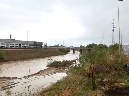
What impacts could El Niño leave this autumn in Spain? The forecast: more heat, more intense rains, and a lot of uncertainty.

The NOAA predicts a very intense episode and AEMET points to temperatures above usual and possible abundant precipitation. However, experts warn that its influence on Spain is not direct nor does it allow for anticipating specific storms.

fotonoticia 20260715134853 1920

fotonoticia 20260715134853 1920

Add DEMÓCRATA to Google

Ask FREN

Published

Last updated

3 minutes

Most read

España vota · Congreso y Senado

Elecciones generales 29 de noviembre de 2026

Se eligen 350 diputados y los senadores de elección directa. Encuestas, calendario, candidaturas, programas y todo lo que necesitas saber para votar.

Faltan 42 días y 17 horas para que abran los colegios electorales.Hasta que abran los colegios, el domingo 29 a las 09:00 (hora peninsular).
Entra en el especial

Próximas fechas

  1. Presentación de candidaturas al Congreso y al Senado21–26 oct · Fecha prevista
  2. Voto desde el extranjero (CERA): envío de la documentación24–30 oct · Fecha prevista
  3. Publicación de las candidaturas presentadasFecha prevista
  4. Proclamación de candidaturasFecha prevista
Calendario completo

The phenomenon of El Niño begins to take shape in the Pacific Ocean and could impact stronger than ever this autumn in Spain. This is reflected in the data from the U.S. meteorological agency, NOAA, when it states that there is more than a 90% chance that a very strong episode will occur between autumn and winter of the northern hemisphere.

The question that still remains unanswered is: how will it affect Spain? The forecasts from the AEMET point to a warmer end of summer and beginning of autumn than usual, with a higher probability of precipitation in much of the country. However, the relationship between El Niño and the weather in the Peninsula is indirect and much less evident than in other regions of the planet.

Why it could be a historic episode

El Niño is a natural climatic phenomenon that occurs when the surface waters of the central and eastern equatorial Pacific reach temperatures higher than usual. This warming modifies atmospheric circulation and can alter rainfall and temperature patterns in different parts of the world.

According to the data from the latest NOAA diagnosis, El Niño will continue to strengthen over the coming months. The U.S. agency estimates that there is a 69% chance that between October and December it will reach a historic intensity, higher than that of episodes recorded since 1950, according to the relative oceanic index it uses to evaluate the phenomenon.

What AEMET predicts

The seasonal forecast from AEMET indicates that, for the quarter of August, September, and October 2026, there is a very high probability that temperatures will rise above the usual values throughout Spain. The forecast also points to a high probability of precipitation above normal in much of the territory. Only the northwest of the peninsula and the Canary Islands will be spared, according to the State Agency.

AEMET specifies that this possible increase in rainfall would be especially related to point convection episodes during August and September. This means that the quarterly balance could be wet even though the precipitation is concentrated on certain days and not distributed regularly.

There will be more rain, but will there be dana?

The intense storms depend on factors that can only be analyzed more accurately when each episode approaches: the arrival of cold air at high altitudes, the position of the depressions, the available humidity, and the direction of the wind. In this sense, the current state of the Mediterranean could influence after having reached abnormally high temperatures. In fact, the European Copernicus service has pointed out that in July 2026, record surface temperatures for that month were reached in areas of the western Mediterranean and the European Atlantic facade.

However, will there be a dana? A warmer sea can provide additional humidity to the atmosphere when the appropriate weather conditions coincide, although this does not indicate that Spain will suffer floods during the autumn. We can only remain attentive to the forecasts of AEMET and follow the recommendations made by the meteorological authority.

The privilege of Spain

The Iberian Peninsula, due to its geographical location, enjoys a certain privilege against adverse atmospheric phenomena. El Niño usually impacts more on regions close to the Pacific or in areas where there is a more stable climatic relationship with this phenomenon. In this line, the European Centre for Medium-Range Weather Forecasts explains that European seasonal forecasts are especially complex because numerous additional factors come into play.

In Spain, the North Atlantic Oscillation, the position of the depressions, the atmospheric circulation, and the temperature of the nearby waters influence immediately, which could reinforce, modify, or even neutralize any influence coming from the Pacific.

More key points, information and questions with FREN

AI-GENERATED CONTENT

What steps does AEMET follow to update its seasonal forecasts in the face of phenomena like El Niño?

AEMET does not publish a detailed step-by-step “manual” on how it updates its seasonal forecasts during El Niño or La Niña episodes, but based on its official notes and public explanations from its officials, a fairly clear outline can be reconstructed: it is a continuous process based on global observations, numerical climate models, and a cautious probabilistic interpretation of the results.

1. Starting point: climate and ENSO monitoring

According to AEMET itself, its forecasting and monitoring work relies on observation networks and numerical models that anticipate the evolution of weather and climate (institutional description collected in the interview with its president in Demócrata). At the climate scale:

  • Long series of temperature and precipitation over Spain are monitored, which are then summarized in seasonal balances (for example, the spring 2026 balance published by MITECO and AEMET, where the season is compared with the 1991‑2020 period and a seasonal forecast is issued for the following summer: note on spring 2026).
  • In parallel, the evolution of the ENSO phenomenon (El Niño–Southern Oscillation) is followed. The literature cited in the press and organizations such as OMSA remind that El Niño and La Niña are temperature anomalies in the tropical Pacific capable of altering global patterns of rainfall, temperatures, and winds (explanatory piece on ENSO).

This contextual information (state of the Pacific, other oceanic anomalies, atmospheric circulation…) is the basis that feeds the seasonal forecasting models.

2. Scenario generation with numerical models

AEMET emphasizes that its seasonal scenarios:

  • Are based on numerical climate models, similar to those used for weather forecasting but designed for horizons of several months.
  • Are always expressed in probabilistic terms, not as a deterministic forecast of specific days. In several official notes (for example, the winter or autumn 2024 summaries, or the spring 2026 balance) there is systematic mention of the “most probable scenario” and probability ranges of 40‑50‑70% that the season will be warmer or wetter than normal.
  • Are generated for moving quarters (for example, April–May–June or July–August–September), approximately coinciding with astronomical seasons, and are accompanied by an interpretative comment on what “warmer” or “drier” means in terms of anomaly relative to 1991‑2020.

In El Niño or La Niña episodes, the ENSO signal is incorporated as a starting condition (forcing) of these models: it is not “added manually” over the forecast, but integrated into the physical system that simulates the atmosphere and ocean. What AEMET does afterward is assess to what extent that signal translates into a robust anomaly over Spain.

3. Periodic updating and uncertainty management

AEMET constantly emphasizes two ideas:

  • Seasonal forecasts have greater uncertainty than short-term forecasts; the probability of success decreases with the lead time and scenarios may change in subsequent updates.
  • Its role is to update the information as new data and new model runs come in, very similarly to what is done with special short-term bulletins (such as the one issued for the August 12 eclipse, which was updated daily as the date approached: note on eclipse).

At the seasonal level, this translates into monthly revisions of the predicted temperature and precipitation anomaly maps. If the actual ENSO evolution differs from what was forecast — for example, an El Niño that remains weaker or intensifies toward a “very strong” episode — the models are re-run with the new observed ocean state and probabilities are adjusted.

4. Interpretation for Spain and public communication

Once the scenarios are generated, AEMET's climatology team:

  • Summarizes the results in bulletins and press conferences where probability maps by regions (Peninsular, Balearic Islands, Canary Islands) are presented, as seen in the climate summaries accompanying MITECO notes.
  • Emphasizes that seasonal forecasts are a planning tool, not a substitute for daily warnings. Therefore, it is stressed that even if a “warmer than normal” summer is forecast, specific episodes (heat waves, DANAs, storms) must be managed with short-term forecasts and the Meteoalert system.
  • In risk contexts (extreme heat, fires, floods) coordinates its messages with Civil Protection or other agencies, to integrate the seasonal signal into emergency management.

In summary, in the face of phenomena like El Niño or La Niña, AEMET does not change its method but strengthens the monitoring of these global anomalies, incorporates them into its climate models, updates seasonal scenarios monthly, and communicates probabilities and limits cautiously: the goal is to anticipate background trends (more heat, more or less rain, more storms), not to promise a detailed calendar of episodes.

What are AEMET's competencies in managing meteorological alerts in Spain?

The State Meteorological Agency (AEMET) is the national meteorological service and the State meteorological authority. Regarding warnings and alerts, its role is essentially technical and preventive: it is responsible for monitoring the atmosphere, forecasting adverse phenomena, and issuing official risk warnings, which serve as the basis for decisions by Civil Protection and other administrations.

Legal basis of its competencies

  • The Spanish Constitution, article 149.1.20., grants the State exclusive competence over the meteorological service. Various resolutions and agreements of AEMET with universities and autonomous communities recall that the Agency exercises this competence as the national meteorological service.
  • The Royal Decree 186/2008, which approves the AEMET Statute, develops this function and recognizes it as the State Meteorological Authority, responsible for the direction, development, and coordination of meteorological activities at the national level (art. 8). See, for example, the agreement resolution with the University of Barcelona published in the BOE: text in the BOE.
  • The Statute itself connects with the Law 40/2015, on the Legal Regime of the Public Sector, which regulates collaboration agreements through which AEMET articulates its cooperation with autonomous communities for managing adverse meteorological phenomena, as in the case of Illes Balears: agreement with Balearic Islands.
  • In the emergency field, the Law 17/2015 of the National Civil Protection System and the various territorial and special plans (floods, fires, etc.) take AEMET warnings as technical reference to activate pre-emergency or emergency phases.

AEMET warnings versus Civil Protection “alerts”

The press and recent parliamentary appearances emphasize a key distinction:

  • Meteorological warnings are technical–scientific and issued by AEMET. They indicate that potentially dangerous phenomena (intense rain, storms, wind, snow, extreme heat, coastal phenomena, etc.) are expected with certain thresholds and probabilities.
  • Civil Protection alerts (including ES-Alert mobile alerts) are administrative and operational: they are activated by the competent Civil Protection authorities (regional or state) when, in view of those warnings and other factors (orography, exposed population, infrastructure, etc.), it is considered necessary to activate plans, order evacuations, confinements, or transmit urgent instructions to the population.

An article from Demócrata summarizes it as follows: AEMET “is the body responsible for predicting meteorological phenomena and issuing risk warnings,” while the ES-Alert mobile alerts are a Civil Protection tool based on those warnings but decided by emergency authorities, not by the Agency.

Operational functions of AEMET in warnings

In the daily management of meteorological risks, AEMET's competencies include:

  • Continuous monitoring and forecasting of the atmosphere through observation networks, radars, satellites, and numerical models, reinforced in singular episodes (for example, special bulletins for phenomena like an eclipse with large public attendance, as explained by the Government in this official note).
  • Issuance of official warnings within the National Plan for Prediction and Monitoring of Adverse Meteorological Phenomena (Meteoalerta), with standardized levels:
    • Yellow: low danger, but with possible impacts on sensitive activities or vulnerable groups.
    • Orange: significant risk to people and property.
    • Red: extreme risk, with potential for very serious and widespread damage.
    These thresholds are adapted to the climatic characteristics and vulnerability of each area.
  • Priority information in emergency coordination centers (such as CECOPI in major crises), where the AEMET representative “analyzes meteorological evolution” and provides real-time data on rainfall and other parameters, considered official and priority information for decision-making.
  • Collaboration with autonomous communities through agreements to:
    • Exchange observation network data.
    • Develop specific forecasts oriented to Civil Protection.
    • Develop adverse phenomenon prediction products adapted to the territory, strengthening resilience and response capacity.
  • Naming of storms and high-impact DANAs, in European coordination, linked to the forecast of orange or red level warnings; this practice aims to improve risk communication and institutional preparedness, as explained by MITECO in this note.
  • Technical support to Civil Protection and other services (112, transport authorities, health, etc.), providing specific information that allows adjusting the activation of plans and devices in the face of storms, heat waves, snowfalls, forest fires, or other risks.

In summary, AEMET does not “order” emergencies nor decide operational alerts, but it does concentrate the state competence to monitor the weather, forecast adverse episodes, and issue official warnings that serve as the scientific basis for decisions by Civil Protection and other administrations in Spain.

What regulations govern the coordination between national and European meteorological organizations in the face of extreme climate phenomena?

Coordination between national meteorological services and the European framework in the face of extreme climate phenomena is supported by a set of Spanish state regulations, international agreements, and, broadly speaking, the EU civil protection framework. Based on what is recorded in the BOE and official texts, several clear legal pillars can be identified.

1. AEMET Statute as national meteorological service

The core of Spanish regulation is the Royal Decree 186/2008, of February 8, approving the Statute of the State Meteorological Agency (AEMET) (official text).

Its preamble defines AEMET as the National Meteorological Service (NMS) and expressly emphasizes:

  • That, according to the World Meteorological Organization (WMO), NMSs are the instrument to fulfill governmental commitments of data and essential product exchange with other countries, among other things for maritime and air transport safety.
  • That the then National Meteorological Institute (now AEMET) carries out its mission in close collaboration with meteorological services of other countries, in organizations such as the WMO, EUMETSAT, EUMETNET, the European Centre for Medium-Range Weather Forecasts (ECMWF), and the Earth Observation Group.

Although the detailed articles are not reproduced here, the Statute configures AEMET as the state body responsible for both international data exchange and operational cooperation, which is the legal basis for its coordination with European observation and forecasting systems used in extreme episodes.

2. Civil protection framework and use of meteorological information

From the emergency management perspective, the key piece is the Law 17/2015, of July 9, on the National Civil Protection System (official text).

Its preamble:

  • Recognizes that disaster risks — including those derived from climate change — can affect national security.
  • Highlights the development of alert systems and the need for integration, coordination, and efficiency among all administrative levels.
  • Explicitly mentions the European Union Civil Protection Mechanism, based on solidarity and collaboration among Member States, and states that the law must facilitate compliance with commitments assumed in that international and European framework.

Law 17/2015 itself foresees state networks of information and alert (such as the National Civil Protection Alert Network), which are fed by specialized sectoral data, including meteorological data provided by AEMET, and which are articulated with the EU civil protection cooperation instruments.

3. Specific European agreements on forecasting and observation

a) European Centre for Medium-Range Weather Forecasts (ECMWF)

Spain's participation in ECMWF is channeled through the Amendment Protocols to the Convention establishing the European Centre for Medium-Range Weather Forecasts, ratified by Spain through the Ratification Instrument published in the BOE (BOE-A-2011-2750).

These protocols reform the Convention to strengthen the Centre's objectives: developing medium-range weather forecasting capacity and supplying those forecasts to Member States, with a clear vocation as a joint international program when resources “generally exceed the national framework.” They imply a stable framework for the coordinated access of national meteorological services to European forecasting products.

b) European Organization for the Exploitation of Meteorological Satellites (EUMETSAT)

In the satellite field, coordination is supported by the Amendment Protocol to the Convention establishing the European Organization for the Exploitation of Meteorological Satellites "EUMETSAT", accepted by Spain and published as an Acceptance Instrument (BOE-A-2000-23493).

The amended text sets as EUMETSAT's main objective to establish, maintain, and operate European operational meteorological satellite systems and establishes that:

  • EUMETSAT must cooperate as much as possible with governments and national bodies of Member States and third countries, as well as with scientific and technical international organizations.
  • It may conclude agreements with these actors to develop its programs.

This obligation of structured cooperation is the legal basis for national meteorological services to receive homogeneous satellite data and for specific products to be designed for extreme risk management.

c) EUMETSAT–National Meteorological Institute (INM/AEMET) Agreement

More operationally, the Agreement between EUMETSAT and the National Meteorological Institute of Spain for the establishment and commissioning of a EUMETSAT Satellite Application Facility (SAF) to support nowcasting and very short-term forecasting (BOE-A-2000-9721) specifies that coordination.

The agreement:

  • Defines the legal framework for the design, development, validation, and commissioning of a Satellite Application Facility (SAF) located in Madrid and managed by the then INM.
  • Establishes that EUMETSAT finances the project and that all data, products, and software developed will be owned by EUMETSAT but will be freely available to all national meteorological services of the Member States.

This ensures a structured flow of specialized satellite products for nowcasting (key in severe convective phenomena, intense precipitation, etc.) that are redistributed from the national service to the European system and vice versa.

4. Connection with extreme episodes and civil protection

Although other cited regulations (such as the Royal Decree-law 11/2019, on urgent measures to mitigate damage from storms, BOE-A-2019-13409) focus on post-disaster aid, their application rests de facto on the analysis and forecasting services of AEMET and, therefore, on the cooperation network described (ECMWF, EUMETSAT, WMO, and the EU Civil Protection Mechanism).

Overall, the AEMET Statute, Law 17/2015, and the ECMWF and EUMETSAT agreements constitute the legal framework that enables and requires operational coordination, data exchange, and joint use of European observation and forecasting systems by national meteorological services, especially relevant when dealing with extreme climate phenomena.

Play

Test your knowledge with FREN!

How much do you know about this topic? Answer the following 3 questions.

What does AEMET predict for the August, September, and October 2026 quarter in Spain regarding the El Niño phenomenon?

Question 1 of 3

What does NOAA indicate about the probability of El Niño reaching a historic intensity between October and December?

Question 2 of 3

Why is the relationship between El Niño and the climate in the Iberian Peninsula less evident than in other regions?

Question 3 of 3