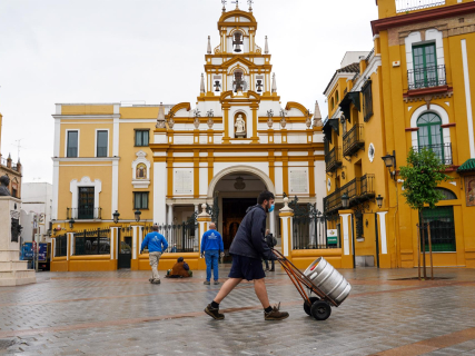
Holy Week kicks off in Spain with eyes on the sky, as millions of citizens plan their trips and activities pending meteorological developments. The first processions have already begun in different parts of the country, as in Cartagena (Murcia) with the Friday of Sorrows, and, for now, rain does not threaten the initial events in Andalusia, one of the main centers of celebration.
Looking ahead to the coming days, the State Meteorological Agency (AEMET) anticipates a changing scenario, marked by the arrival of precipitation in the north, a drop in temperatures and the return of snow in mountain areas. Meanwhile, the Canary Islands will remain outside the storm after the passage of storm Therese.
First days with stability, except in the north
During the start of the period, stability will prevail in a good part of the country, although rains are expected in the Cantabrian area that could extend to the rest of the northern third. Also possible are occasional showers in the Balearic Islands.
One of the most prominent elements will be the snow. The snow level will drop notably in the north, especially at the end of Saturday, which could leave snowfalls in mountain areas and even at lower elevations than usual.
The temperatures will be variable, with frosts in mountain areas and in points of the plateau, while the wind will blow strongly in several areas, especially in the northeast, Balearic Islands, Galicia and the Ebro valley. In the south, the easterly wind will be prominent in the Strait and Alboran.
Entry of polar air and widespread drop
Sunday will be marked by a sharper change. The arrival of a mass of polar air will affect the Peninsula and the Balearic Islands, causing a generalized drop in temperatures.
Precipitation in the north could turn into snow in wide areas, with elevations that could drop to 400-700 meters and significant accumulations. In the Balearic Islands, furthermore, episodes of intense rain are expected.
The wind will gain prominence, with very strong gusts in a large part of the territory, especially in the center, the peninsular east and the Balearic archipelago. In the Canary Islands, however, stable weather will be maintained, with intense trade winds.
Week with uncertainty until Holy Thursday
From the beginning of the week and until Holy Thursday, the forecast points to a trend towards stability, although with precipitation still present in the northern third, mainly in the form of snow in mountainous areas.
However, AEMET warns of the possible influence of a low-pressure system with high uncertainty, which could affect the east and south of the peninsula and, especially, the Balearic Islands. If confirmed, the rains could be intense and abundant.
Temperatures will tend to recover, although frosts will continue to be registered in mountain areas and on the northern plateau, while the wind will continue blowing with force in the northeast and elevated areas of the center.
Canary Islands, apart from the storm
In contrast with the Peninsula, the Canary Islands will maintain a stable situation throughout the week, with a predominance of trade winds, intervals of strong wind and a slight rise in temperatures. The presence of calima is not ruled out at some moments.
Overall, Holy Week starts with favorable weather in many regions, but with an unstable meteorological scenario on the horizon, which could affect travel and celebrations on the key days.