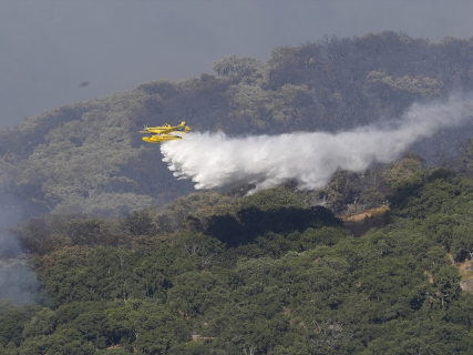

Spain faces the start of summer with a worrying statistic: it is the country in the European Union that has lost the most surface area due to forest fires during the first half of 2026. According to the records of the European program Copernicus, fire has ravaged 50,384 hectares, nearly 40% of all the surface area burned in the EU so far this year. The situation coincides with a heat wave that keeps large areas of the country at very high or extreme fire risk, while several significant fires continue to be active in communities such as Catalonia or Andalusia.
Map of active fires in Spain today
Detections can be tracked through an interactive map created from data from NASA's FIRMS (Fire Information for Resource Management System). The platform uses the VIIRS sensors installed on the Suomi NPP and NOAA-20 satellites, capable of locating thermal anomalies with an approximate resolution of 375 meters per pixel. The satellites fly over the Iberian Peninsula twice a day, and the information is usually available between one and three hours after each pass, so the viewer offers a practically real-time snapshot of the detected hotspots.
Source: NASA FIRMS (VIIRS satellites, 375 m resolution). Detections from the last 24 hours.
Not all points correspond to forest fires
Experts recall that these detections do not automatically equate to forest fires. The system identifies thermal anomalies that may also correspond to agricultural burns, industrial facilities, or other intense heat sources.
To reduce errors, the viewer eliminates detections with low reliability, hotspots with low radiative power, and those that appear in isolation, criteria that help filter possible false positives. The size of each point represents the radiative power of the fire (FRP), an indicator used to estimate the intensity of the detected hotspot.
In any case, the map indicates a summer marked by extreme risk. With weather forecasts pointing to the continuation of high temperatures in the coming days, emergency services maintain reinforced surveillance in a large part of the national territory. Authorities insist on exercising extreme caution, as current conditions favor the rapid spread of any fire that may break out.
Why are there more and more fires in summer?
Experts agree that the increase in large forest fires is due to a combination of climatic, environmental, and human factors. The main one is the increase in temperatures associated with climate change, which is lengthening the fire season and favoring more intense heatwaves, prolonged droughts, and increasingly dry and combustible vegetation.
Added to this is the accumulation of biomass in the mountains. The abandonment of many rural areas and the reduction of traditional activities, such as grazing or forestry, have led to forests and scrublands accumulating a large amount of fuel. When a fire starts, the flames find it easier to spread and reach much greater intensity.
Although weather conditions are decisive, most fires in Spain still have a human origin, whether due to negligence—such as agricultural burns, work with machinery, or poorly extinguished cigarette butts—or intentional actions. Added to this is the growth of urban developments and homes near forest areas, which increases both the risk of ignition and the complexity of firefighting efforts.
As a consequence of all these factors, specialists warn that the so-called large forest fires, capable of exceeding 500 hectares and behaving in an extreme manner, are becoming increasingly frequent. In the most serious episodes, the fire can generate its own atmospheric dynamics, hindering the work of emergency teams and sometimes forcing them to prioritize the protection of the population over extinction efforts.