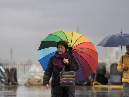

Catalonia faces another episode of potentially torrential rains during this weekend. The Meteorological Service of Catalonia (Meteocat) has raised this Saturday to the maximum danger level, 6 out of 6, the warnings for precipitation intensity in different regions of the provinces of Tarragona, Barcelona, and Girona. The worsening is expected to start from the afternoon of this October 3 and will continue through Sunday, with particular concern for the possibility that the showers will release a large amount of water in very short periods.
The forecast includes precipitation capable of exceeding 40 millimeters, equivalent to 40 liters per square meter, in just 30 minutes. Meteocat also warns of accumulations exceeding 90 liters in three hours and of points where the total balance of the entire episode could exceed 200 liters per square meter in 24 hours. For these last thresholds, danger warnings of level 5 out of 6 also remain active.
The central coast, among the first affected areas
According to the expected evolution by the Catalan meteorological service, the precipitation will gain intensity during the afternoon of this Saturday and will initially have the central coast of Catalonia among the most exposed areas. The episode will also extend towards the inland regions of Girona, while different points in Tarragona will also remain under surveillance.
⚠ El Servei Meteorològic de Catalunya emet avís de situació meteorològica de perill (#avisosSMP) per acumulació de pluja ⚠
— Meteocat (@meteocat) October 3, 2026
🗓️ Ds. 20:00 a dg. 20:00 h
🌧️ Possibilitat de precipitació > 200 mm / 24h
🔴 Grau de perill màxim: 5/6
Hora local (h) = TU +2 pic.twitter.com/iJ3sKEdrKA
Not all of Catalonia will receive the same amounts nor will the showers occur uniformly. Precisely one of the main risks of this type of episodes is its local and very intense nature: a storm can leave dozens of liters in a few minutes over a municipality while relatively nearby towns register much lower amounts. This concentration favors sudden floods, problems in underground passages, streams, and ravines, and difficulties in circulation.
Up to 200 liters per square meter
The warning is not limited to instantaneous intensity. Meteocat contemplates that persistent precipitation could bring accumulations to exceptionally high values in some points, with the possibility of exceeding 200 millimeters in 24 hours. The agency therefore maintains level 5 out of 6 warnings related to accumulation, in addition to the maximum level 6 for certain episodes of intensity.
The combination of both factors raises the risk: a precipitation of 40 liters in half an hour can cause immediate drainage problems and rapid rises, while several hours of rain over already saturated ground subsequently increase the possibility of overflow and landslides. Catalonia also arrives at this weekend after several days of instability, especially hard in the Terres de l'Ebre, where the previous episode left accumulations exceeding 200 liters per square meter in some points.
INUNCAT remains on alert
Civil Protection had downgraded on Friday the Special Emergency Plan for Floods of Catalonia (INUNCAT) from the emergency phase to the alert phase after the situation improved in the south of the community, but warned that the risk had not ended and maintained vigilance in the face of new rains expected for the weekend. The update from Meteocat now confirms a new increase in meteorological danger.
INUNCAT is the mechanism with which the Generalitat coordinates the response to flooding episodes and establishes actions for emergency services, municipalities, and agencies responsible for infrastructure. Civil Protection recommends exercising extreme caution in affected areas, especially near streams, ravines, and flood-prone points, and avoiding crossing areas covered by water, whether on foot or by vehicle.
What a level 6 out of 6 warning means
The grade 6 is the maximum of the danger scale used by Meteocat, so it indicates a scenario in which meteorological phenomena of exceptional intensity can occur and have the capacity to cause significant incidents. It does not mean that it will rain with that intensity in all the municipalities included in the warning area, but rather that the conditions make it possible to reach those thresholds in certain places.
The forecast itself may be modified during the next few hours depending on the movement of the storms. Meteocat keeps its warning maps updated for this Saturday 3, Sunday 4, and Monday 5 of October, so it is advisable to check the specific situation of each region before traveling.
A weekend marked by rain
The most adverse scenario is concentrated from the afternoon of this Saturday and will extend into Sunday. Tarragona, Barcelona, and Girona appear as the main regions under surveillance in this new update, with risk both from extremely intense downpours in a few minutes and from the large amounts of water that may accumulate over several hours.
The recommendation is to follow the updates from Meteocat and Civil Protection and to take extreme precautions on the road and in flood-prone areas. With warnings reaching the maximum level of danger and potential accumulations exceeding 200 liters per square meter, the evolution of the storms over the next few hours will be decisive in understanding the real extent of the episode.