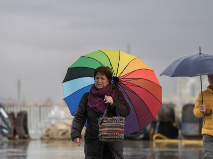

The rains and storms return to mark this Saturday a good part of the map of Spain after several days of bad weather. The State Meteorological Agency maintains warnings in about fifteen autonomous communities for precipitation, storm activity, and possible hail, with the most adverse phenomena concentrated again in the Mediterranean area. Catalonia, Comunitat Valenciana, and Balearic Islands are among the territories with the highest risk, while in the two plateaus, Aragon and the Iberian system, strong storms may also occur during the afternoon.
The most extreme episode of the last few days has lost intensity. AEMET lifted the red warnings that had affected Tarragona, Castellón, and Valencia, after accumulations exceeding 250 liters per square meter were recorded in some points of Tarragona and more than 170 in Castellón. However, the withdrawal of the maximum alert level does not mean that the risk has ended: this Saturday very strong precipitation and locally intense storms remain possible.
Fifteen communities with warnings this Saturday
The warnings affect Andalusia, Aragon, Asturias, Castilla y León, Castilla-La Mancha, Catalonia, Extremadura, Galicia, Community of Madrid, Region of Murcia, Basque Country, La Rioja, Comunitat Valenciana, Balearic Islands, and Cantabria. The intensity and the predicted phenomenon vary in each territory: in some areas the alert mainly responds to intense rains and in others to the risk of storms accompanied by hail and strong gusts of wind.
In Andalusia, warnings are expected for rains and storms in provinces such as Almería, Granada, Jaén, and Sevilla, while other points may be mainly affected by storm activity. Castilla y León presents warnings in a good part of its provinces and Castilla-La Mancha maintains risk in areas of Albacete, Ciudad Real, Guadalajara, and Toledo. Madrid, Extremadura, Aragon, and the surrounding area of the Iberian system are also among the areas where showers may gain strength as the day progresses.
Comunitat Valenciana and Tarragona remain under surveillance
The main focus of attention remains situated in the eastern peninsula. The combination of cold air aloft and humidity from the Mediterranean maintains favorable conditions for the formation of very intense and localized storms. AEMET warns of very heavy precipitation in the coastal waters of Valencia and Murcia, while in Tarragona and, with lower probability, Barcelona, heavy downpours and storms of great intensity remain possible.
The early morning has still been marked by the remnants of the storms that hit different points of the Comunitat Valenciana and Catalonia during Friday. In Alzira, for example, 97 liters per square meter were measured in just one hour during the previous afternoon, while stations in the area recorded even greater totals throughout the episode. This type of extremely concentrated precipitation explains why Civil Protection continues to urge caution even though the red alert has disappeared.
During Saturday, the expected trend is that the most intense storms in the Mediterranean will gradually lose strength and move towards coastal sectors. In the waters near Tarragona, AEMET maintains the possibility of very heavy precipitation with storms until 8:00 PM, although for the subsequent period it no longer anticipates maritime warning conditions in that area.
Storms with hail in the plateaus and Aragón
Instability will also extend towards the interior of the Peninsula. During the afternoon, showers accompanied by storms and hail are likely in both plateaus, Aragón, and the Iberian system, with episodes that can be locally strong. The nature of these storms means that rainfall amounts can vary significantly over short distances: one locality may record an intense downpour while another nearby receives little precipitation.
Madrid is also among the communities under alert. Storms may appear irregularly, especially as daytime instability increases, while in the southeast and the Balearic Islands there is a possibility of even more intense episodes. AEMET itself warns that, on a day like this, strong showers can occur in a very localized manner and with little notice.
Balearic Islands, another of the most affected points
The Balearic archipelago is located among the areas where storms can reach greater intensity this Saturday. The Mediterranean continues to provide a high amount of humidity and the cold air at high levels favors the rapid growth of storm clouds, so heavy or very heavy downpours accompanied by electrical activity, hail, and intense gusts are possible.
The situation is part of a more prolonged episode that will not necessarily end with the weekend. Forecasts indicate that instability may persist over the next few days, with the formation of a cut-off low on Sunday, although its position and evolution still present uncertainty. AEMET expects a gradual improvement in some Mediterranean areas at the beginning of next week, while rains could continue in other areas until midweek.
Persistent rains in La Palma and haze in the Canary Islands
The Canary Islands are in a different situation than the Peninsula. More cloudy skies are expected on the northern slopes of the islands and persistent precipitation in La Palma, while a slight influx of haze from the east may also affect the archipelago. Temperatures will hardly experience significant changes and the regime of moderate trade winds will continue.
In the Peninsula, mist and fog banks may also appear during the early hours, especially in southeastern areas and elevated areas of the far north. Visibility may be reduced locally before the increase in instability favors the appearance of afternoon showers.
Temperatures drop in the Mediterranean
The episode will also leave significant differences in thermometers. Maximum temperatures will decrease in the Mediterranean arc and the Balearic Islands, precisely the areas most affected by clouds and precipitation, while they will rise in much of the rest of the country. The rise may be especially pronounced in the upper Ebro.
Minimums will tend to increase in the western Peninsula and decrease in the east and the Balearic Islands. As for the wind, it will be moderate along numerous coastlines, with a northeast component in Galicia and predominance of the east in the Balearic Islands and the Cantabrian, Mediterranean, and Alboran coasts. In storm areas, strong or very strong gusts may occur suddenly.
The storm loses intensity, but the risk continues
Saturday thus represents a new phase of an episode that reached its most dangerous moment between Thursday and Friday. The red alerts have already disappeared, but there are still numerous yellow and orange alerts and precipitation capable of causing problems remains possible, especially in areas that have already accumulated large amounts of water and where the ground is saturated.
The recommendation continues to be to consult the updates from AEMET and Civil Protection before making trips, to avoid riverbeds, gullies, and flood-prone areas during a storm, and not to cross roads covered by water. Fifteen communities remain this Saturday under some type of alert and the Mediterranean continues to concentrate the greatest risk, although the situation will evolve throughout a day again marked by showers, hail, and storms.