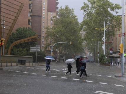

A new depression threatens to leave precipitation exceeding 300 liters per square meter in points of the province of Valencia between Sunday, October 18, and Monday, October 19. The arrival of this meteorological phenomenon will put an end to the almost summery atmosphere of recent days and will give way to an episode of intense and persistent rains in much of the Mediterranean.
According to the weather forecasts released this Friday by Antena 3, the depression has not yet formed, but it is expected to be located north of the Peninsula and favor the entry of cold air at altitude. This situation will increase instability and could trigger storms of great intensity in the Valencian Community, Catalonia, and the Balearic Islands.
The models indicate that the most complicated moment will arrive during the night of Sunday and the morning of Monday, when the precipitation could reach its highest accumulations in Valencia. However, the expected amounts are still subject to change as the atmospheric situation evolves.
Valencia, in the focus of the most intense rains
The province of Valencia appears as one of the most exposed areas to the episode, with accumulations that could exceed 300 liters per square meter in just two days, according to estimates released by meteorologist César Gonzalo.
The rains could also be strong and persistent in other points of the Valencian Community and in the Balearic Islands. In Catalonia, the precipitation would gain intensity during the night of Saturday, although it is expected to lose strength throughout Sunday.
In light of this scenario, it is especially important to avoid ravines, gullies, and dry riverbeds, as torrential rains can cause sudden rises even in places where it is not raining at that moment.
The evolution of the depression and the final distribution of the precipitation will determine the most affected areas. Therefore, it will be necessary to follow the updates from the State Meteorological Agency (AEMET) and the warnings that civil protection services may issue.
On Saturday, the weather change will begin
Before the arrival of the most intense rains, this Friday a cold front will reach the Cantabrian Sea and will leave light precipitation in the north of Galicia and Asturias, with the possibility of some showers in Cantabria and the Basque Country.
The instability will also increase in the south of Castilla y León and the east of Andalucía, where strong storms could be recorded. In Cuenca and Canarias, some precipitation of lesser intensity is expected.
During Saturday, the showers will spread across different areas of the Peninsula, while the northwest will remain relatively outside the episode, with a predominance of clear skies.
As the day progresses, the rains could intensify on the Catalan coast, before moving towards other areas of the Mediterranean during Sunday.
Drop in temperatures during the weekend
The arrival of the dana will also be accompanied by a marked drop in temperatures, especially in the north and central peninsula, after several days with values more typical of summer.
The forecasts for Sunday point to maximums of barely 14 degrees in Burgos and 15 in Pamplona, while Oviedo, Logroño, and Lleida will hover around 17 degrees.
In Madrid and Cuenca, thermometers could remain around 18 degrees, which will represent a notable change from the warm atmosphere of recent days.
In the southern peninsula, a drop in temperatures is also expected, although less pronounced.
Precaution against possible floods of ravines and dry riverbeds
The main risk of this episode will be associated with the intensity and persistence of the precipitation, especially in the Mediterranean areas where accumulations could be very high in a relatively short period.
Heavy rains can cause local flooding, water accumulation on roads, and sudden floods of ravines and dry riverbeds. For this reason, it is recommended to avoid unnecessary travel in flood-prone areas when intense storms occur.
The forecast of more than 300 liters per square meter is still a meteorological estimate, not a confirmed amount or an official warning from AEMET. Its evolution over the next few hours will allow for a more precise assessment of both the accumulations and the areas of greatest risk.