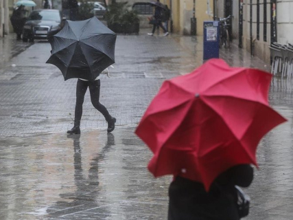

The jet stream, known in Spanish as corriente en chorro, is one of the keys to understanding why the weather changes. Although its winds blow far from the surface, it influences the movement of weather systems and, with it, the temperatures and precipitation recorded on land. NOAA, the U.S. agency dedicated to the ocean and the atmosphere, explains that these currents act as a guide for the advance of storms.
In Spain, the evolution of the polar jet over the Atlantic is particularly relevant for understanding the arrival of fronts.
What is the jet stream or polar jet stream?
The jet stream is a relatively narrow band of very fast winds that predominantly circulates from west to east, near the tropopause, the boundary between the troposphere and the stratosphere. Its formation is related to the temperature contrasts between different regions of the planet and to the Earth's rotation.
There are several jet streams. Among them, the polar and subtropical ones stand out, whose positions change and which, in certain situations, can merge. Therefore, the English term jet stream designates a broader phenomenon than the polar jet.
The polar jet stream is found approximately between 8 and 15 kilometers above the surface, according to the explanatory publication released by Aemet. It is associated with the separation between the cold air of polar regions and the warmer air of mid-latitudes.
How does it influence the weather in Spain?
The jet stream helps to guide the path of storms. Its changes in position can displace the areas through which weather systems advance and modify the distribution of rainfall. That is why knowing its trajectory is part of weather forecasting.
Its path presents undulations. In weather maps, they appear as troughs, which extend towards lower latitudes, and ridges, which extend northward.
Troughs are usually associated with low pressures and fronts, while ridges tend to accompany anticyclonic situations. Their succession helps to explain why unstable days and periods of calmer weather alternate over the Peninsula.
Why does the polar jet change position?
The jet stream varies with the seasons. In the northern hemisphere, it tends to shift northward during the summer and lose intensity. With the arrival of winter, it usually drops in latitude and regains strength.
This seasonal behavior is added to its interactions with the oceans, the relief, and other patterns of atmospheric circulation. The result is a changing trajectory, with undulations that condition the movement of the storms.
Does a stronger jet stream mean a cold wave is coming?
An increase in its speed is not enough to announce a cold wave in Spain. The effects also depend on the shape that the current takes and the position of the air masses. Large undulations can favor cold air reaching more southern latitudes and warm air advancing northward. To determine which territory will be affected, the complete atmospheric configuration must be analyzed.
The jet stream winds, which blow at kilometers high, should not be confused with the gusts expected in a locality. A surface wind forecast requires its own analysis.
What is the relationship between the jet stream and danas?
An undulation of the jet can evolve until it becomes separated from the main circulation. When a closed and isolated depression forms at high levels, it is referred to as a dana.
Aemet explains that this process can occur due to the separation of a trough from the jet stream. This relationship helps to understand the origin of these depressions, although their formation does not solely determine where the most intense precipitation will occur.
Is the polar jet the same as the polar vortex?
They are different phenomena. The polar jet circulates in the troposphere, while the stratospheric polar vortex develops at a higher altitude, approximately between 16 and 48 kilometers above the North Pole during winter.
Both can interact, but an alteration of the vortex does not automatically imply a cold episode in Spain. Aemet reminds that its effects at the surface vary and that cold air entries can also occur without a decisive intervention from the vortex.
What does Aemet forecast for the Cantabrian coast this Wednesday?
To know the concrete consequences of the episode, one must refer to the forecasts by areas. The maritime bulletin from Aemet consulted for this Wednesday, October 21 reports an increase in the background sea from the northwest up to 3 or 4 meters in coastal waters of Asturias, Cantabria, Bizkaia, and Gipuzkoa, in addition to intense wind.