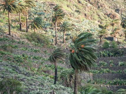

The downbursts that have accompanied the storms in Valencia this Thursday have left wind gusts of up to 149 kilometers per hour and numerous material damages. Although they can be confused by their effects with other violent phenomena, their origin lies in a current of air that falls from a storm and extends abruptly upon reaching the surface.
The episode has particularly affected the province of Valencia. In Sumacàrcer, gusts of 149 kilometers per hour have been recorded and in Alzira, 143 km/h, while in the latter locality, damage has occurred to trees, roads, and buildings.
The phenomenon recorded this Thursday has been described as warm downburst, a modality that presents important differences compared to the cold downburst that affected, for example, Cullera in August 2022.
What exactly is a downburst
The State Meteorological Agency defines downbursts or downbursts as strong descending currents normally associated with storms that, upon reaching the ground, expand horizontally and generate very intense wind gusts.
The process begins within a storm cloud. The air descends rapidly, favored by mechanisms such as the cooling produced by the evaporation of water and the weight of the raindrops or ice particles. This mass of air gains speed as it falls.
When it reaches the surface, it can no longer continue descending and moves laterally in several directions. It is then that sudden gusts capable of exceeding 100 kilometers per hour appear.
Downbursts usually affect relatively small areas. AEMET notes as a reference that they can have a horizontal extension of less than about ten kilometers; when they are especially small, they are called micro downbursts or microbursts.
What is the difference between a warm downburst and a cold one
Not all downbursts behave the same.
In a warm downburst, the descending current reaches the ground while still containing liquid water. The air that reaches the surface is, therefore, cold and humid, and the phenomenon is usually accompanied by intense precipitation and a sharp drop in temperature.
This is precisely the pattern that has been observed this Thursday in Valencia. In Polinyà de Xúquer, for example, the arrival of the storm caused a drop from 37.7 to 18.1 degrees, almost 20 degrees in a short time, in addition to strong wind gusts.
The warm downburst, on the other hand, has a different evolution. All the water from the descending current can evaporate before reaching the ground. From that moment on, the air begins to heat up due to compression while continuing to descend.
The result can be a particularly striking combination: a sudden increase in temperature, a drop in humidity, and strong gusts of wind. AEMET considers that, to classify an episode as a warm downburst in its SINOBAS system, the temperature increase must be at least five degrees.
Why the air can fall so quickly
The key lies in the difference in density between the air masses.
When rain or hail begins to evaporate during its fall, it consumes energy from the surrounding air. That air cools down, gains density, and tends to descend more quickly.
The current can continue to accelerate until it reaches the lower layers of the atmosphere. Upon hitting the surface, all that energy transforms into a very strong horizontal wind.
That is why a downburst does not need a tornado to cause serious damage. The distribution of the wind, however, is different: in a downburst the air disperses from the impact zone, while in a tornado the wind rotates around a center.
Heat and storms favor these phenomena
Downbursts appear linked to situations of strong atmospheric instability and storms, although the specific conditions determine what type of phenomenon ends up developing.
Warm downbursts are especially characteristic of situations where there is dry air in layers of the atmosphere and storms that begin to weaken. Many occur during the night or early morning, when there may be a thermal inversion near the surface.
The episode in Valencia comes precisely after a day of extreme heat, with temperatures that on Wednesday reached around 44 degrees in some points of the Comunidad Valenciana, followed by the entry of cooler air and intense storms.
Why they are difficult to predict
The prediction of a specific downburst is particularly complicated because it is a phenomenon very localized and rapidly evolving.
Meteorologists can indeed identify favorable environments for severe storms and issue warnings for strong gusts of wind, hail, or intense precipitation. Determining in advance the exact point where a downdraft will hit the surface is much more difficult.
This reduced scale explains that a locality can suffer extraordinarily strong gusts while, a few kilometers away, the effects are much smaller.
How long a downburst lasts
Another of its characteristics is its short duration. The most violent wind can occur for just a few minutes, although the storm that causes it may remain active for longer.
Its brevity does not necessarily reduce its destructive capacity. The sudden force of the gusts can topple trees, tear off roofs, displace objects, and affect poorly resistant or poorly anchored structures.
This Thursday, AEMET has precisely requested caution due to the wind in Valencia, especially near fragile structures, while the storms were crossing the province towards the coast.