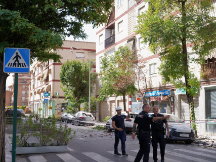

The succession of earthquakes recorded in Granada has returned a disturbing question: what has been the strongest earthquake in the history of Spain? The answer depends on the criterion used, because the earthquake of greatest magnitude does not necessarily coincide with the deadliest or most destructive.
The largest known earthquake that has affected Spain was the one that occurred on November 1, 1755, southwest of Cape San Vicente, with an estimated magnitude of 8.5. However, its epicenter was located in the Atlantic Ocean, outside the current Spanish territory. History shows that magnitude does not explain everything. Depth, distance from populated areas, soil type, and building resilience can make a moderate earthquake more destructive than another considerably larger.
Cape San Vicente, 1755: magnitude 8.5
The earthquake of November 1, 1755, commonly known as the Lisbon earthquake, reached an estimated magnitude of 8.5 and a maximum intensity of X.
Its epicenter was in the Atlantic, southwest of Cape San Vicente, but its consequences arrived with enormous violence in Spain. The shaking caused damage in numerous localities and generated a catastrophic tsunami that particularly affected the Gulf of Cádiz.
The IGN catalog records waves of up to 13 meters and observations from the Caribbean to the United Kingdom. It was the largest known earthquake that has affected Spain, although it cannot be strictly considered an earthquake with an epicenter within national territory.
Dúrcal, Granada, 1954: magnitude 7.8
On March 29, 1954, a magnitude 7.8 earthquake was recorded south of Granada. It is the largest shaking measured instrumentally with an epicenter located under Spanish territory.
Its focus, however, was at a depth of more than 600 kilometers. This circumstance dampened its effects on the surface and explains why it only reached an intensity of V, much lower than that of other historical earthquakes of lesser magnitude.
Queralbs, Girona, 1428: estimated magnitude 7.3
On February 2, 1428, an earthquake of estimated magnitude 7.3 shook the Catalan Pyrenees. Its epicenter was located near Queralbs, in Girona, and reached an intensity of between IX and X.
The IGN estimates about 800 victims and notes that Queralbs was destroyed. It was the culminating episode of a seismic crisis that began in 1427 and continues to be one of the largest known surface earthquakes with an epicenter in Spain.
Vega de Granada, 1431: estimated magnitude 6.7
On April 24, 1431, an earthquake of estimated magnitude 6.7 shook southern Granada. The quake reached an intensity of between VIII and IX and caused severe damage to the Alhambra, in addition to affecting other buildings in the city and its surroundings.
The earthquake occurred during the Nasrid reign and constitutes one of the main historical references regarding the destructive capacity of earthquakes in the Vega de Granada.
Torrevieja, Alicante, 1829: estimated magnitude 6.6
On March 21, 1829, an earthquake of estimated magnitude 6.6 destroyed Torrevieja and Guardamar del Segura. It reached an intensity of between IX and X and caused around 400 deaths.
The IGN considers it one of the largest and most violent historical earthquakes recorded on the Peninsula. The subsequent reconstruction even influenced the urban design of Torrevieja, with wider streets and shorter buildings.
Arenas del Rey, Granada, 1884: estimated magnitude 6.5
On the night of December 25, 1884, an earthquake of estimated magnitude 6.5 devastated numerous populations in Granada and Málaga. Its epicenter was located near Arenas del Rey and reached an intensity of between IX and X.
Known as the earthquake of Andalucía, it caused around 840 deaths and destroyed or severely damaged thousands of buildings. It was one of the largest natural disasters in contemporary Spain.
Almería, 1522: estimated magnitude around 6.5
The earthquake that occurred on September 22, 1522 was one of the deadliest documented in Spain. The IGN places its origin in the area of Alhama de Almería and estimates that it caused approximately 1,000 deaths.
The city of Almería and other nearby towns suffered enormous destruction. The historical catalog of the IGN also records a disturbance of the sea associated with the earthquake, although its degree of reliability is limited.
Baza, Granada, 1531: estimated magnitude between 6.2 and 6.5
The Baza basin trembled violently again in 1531. According to the National Geographic Institute, the earthquake caused about 400 casualties and destroyed more than 60% of the city's homes.
It is considered one of the major cortical earthquakes recorded in the central area of the Betic mountain ranges. Its magnitude falls within the range of the major historical earthquakes of the region, although there is no direct instrumental measurement.
Alhaurín el Grande, Málaga, 1680: intensity VIII-IX
The October 9, 1680, a great earthquake located in the surroundings of Alhaurín el Grande caused significant damage in Málaga and in numerous Andalusian towns.
The episode reached an estimated intensity of between VIII and IX. There are also historical references to a disturbance of the sea off Málaga, although the IGN's own catalog considers the possibility of a tsunami to be disputed.
The absence of a sufficiently consolidated magnitude estimate prevents it from being precisely placed against other historical episodes.
Lorca, Murcia, 2011: magnitude 5.1
On May 11, 2011, an earthquake of magnitude 5.1 and barely four kilometers deep shook Lorca. Nine people died and numerous buildings suffered damage.
Its magnitude was much lower than that of the great historical earthquakes, but the epicenter was located about five kilometers from the city. The shallow depth, proximity to homes, and the vulnerability of some constructions multiplied its destructive capacity.
Lorca thus left one of the main lessons of seismology: an earthquake does not need to reach an extraordinary magnitude to cause a catastrophe.
So, what has been the strongest earthquake in Spain?
The strongest earthquake that has affected Spain was the one off Cape San Vicente in 1755, with an estimated magnitude of 8.5, although its epicenter was in the Atlantic. The largest instrumentally recorded under Spanish territory was the one in Dúrcal in 1954, with a magnitude of 7.8, but its enormous depth considerably reduced the damage.
Among the most destructive shallow earthquakes are those of Queralbs, Almería, Torrevieja, and Arenas del Rey. The latter also confirms the historical prominence of Granada, the province that concentrates four of the ten episodes included in this selection.
The case of Lorca provides the most recent lesson: magnitude is only part of the story. Depth, proximity to a city, and the resilience of buildings can be much more decisive when the ground begins to shake.